July 24, 2022
Tantura was distinguished by its prominent location overlooking the Mediterranean coast, serving as a link for commercial activity between the country’s major cities. This article explores the village’s overall landscape, as well as its economic and educational life, through a selection of digital materials.
“The sea is the village’s boundary. It lends it its sounds and colors, wraps it in its scents, and we can smell it even in the aroma of taboon bread.”
This is how Palestinian writer Radwa Ashour began her description of Tantura and its unique, deep-rooted relationship with the Mediterranean Sea, blending the characteristics of the sea and the land.
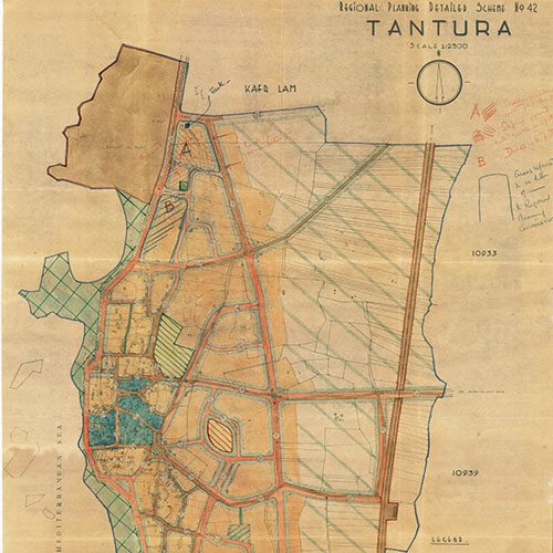
Tantura was located on the coast, approximately 24 kilometers west of Haifa, and was surrounded by several Arab towns and villages, including al-Fureidis, Ein Ghazal, Ijzim, and Jisr al-Zarqa.
Before 1948, the land belonging to Tantura was estimated at more than 12,000 dunams. According to population statistics up to 1945, the village had approximately 1,940 Arab inhabitants (al-Khalidi, 1997).
As for its name, the word “Tantur” refers to a slightly elevated place resembling a somewhat conical hat. Tantura was situated on a small hill and appeared somewhat conical in shape.
This article examines the general landscape of Tantura, as well as its economic and educational life, through digital materials, including photographs and newspaper reports from Jara’id, an archive of historic Palestinian newspapers.
Geographic Location and General Landscape
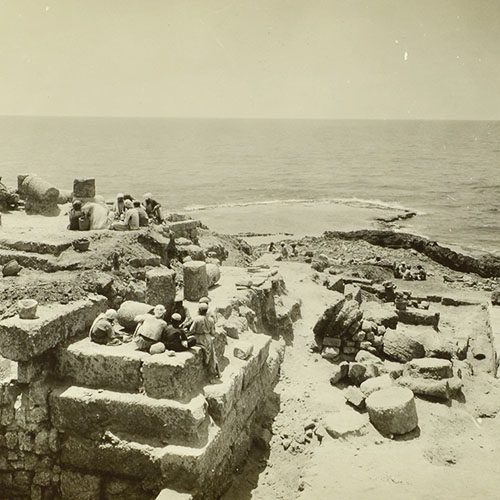
Tantura was distinguished by its prominent location overlooking the Mediterranean coast. Along the shoreline were several rocky islands and caves. The village also occupied a position roughly midway between Haifa and Jaffa, making it a link for commercial activities between the two major cities.
When Napoleon Bonaparte sought to capture Acre, he passed through Tantura and established a military base there for his forces advancing toward the city. Later, after their defeat at the walls of Acre, his troops rested in the area.
In addition, a railway station was established in Tantura as part of the railway route toward Haifa. The harbor of Tantura was also one of the important commercial ports along the Palestinian coast.
Economic Activity in Tantura
As mentioned earlier, Tantura’s strategic location made the village an important commercial hub for both maritime and overland trade. Its residents exported agricultural products, including grains such as lentils, beans, and sesame, as well as fruit such as figs, pomegranates, apples, and lemons. Tantura was also renowned for its watermelon season, with produce exported to the cities of Haifa, Jaffa, and Gaza, as well as to Egypt and Lebanon.
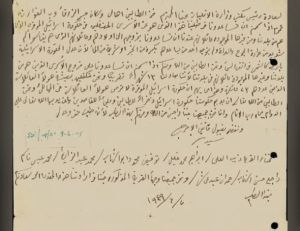
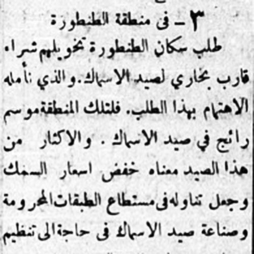
Tantura was also well known for fishing. The village and its local council sought government assistance in providing fishing boats so that production could increase, prices could fall, and low-income families could afford to purchase fish at reasonable prices, as reported by the newspaper Al-Difaʿ in 1943.
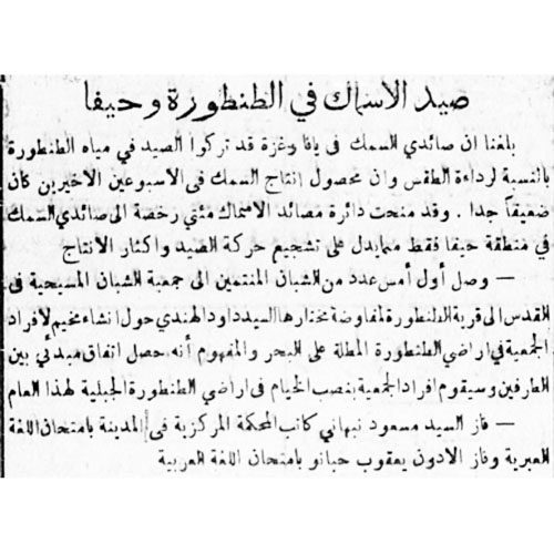
Similarly, Al-Difaʿ reported in 1941 that the Department of Fisheries had taken an interest in issuing boat licenses to 200 fishermen in an effort to encourage fishing activity in the Haifa area and increase production, thereby improving the village’s overall income.
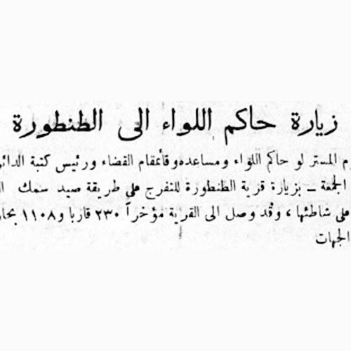
The fishermen of Tantura were particularly known for a distinctive fishing method of their own. This prompted the district governor to visit Tantura during the fishing season to observe the technique.
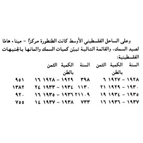
Dr. Shukri al-ʿArraf documented the production and economic returns of fishing in Tantura and other Arab areas in his book Sources of the Palestinian Economy. The newspaper Al-Ittihad subsequently published summaries of the book in several installments across different issues.
Educational Life
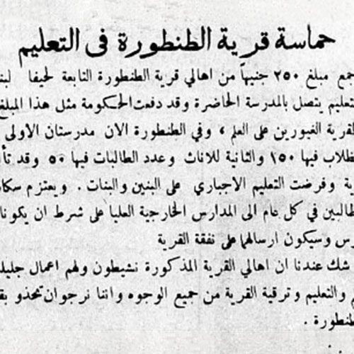
Tantura served as an educational center for the boys and girls of the surrounding villages. The boys’ school was established in 1889 and provided education up to the seventh grade. After completing their studies there, students generally attended schools in central Haifa. The village council encouraged high-achieving students to continue their education, covering the tuition costs for the top two students.
A girls’ school was established in 1938 and provided education up to the fourth grade. Girls wishing to continue their studies could attend schools run by the Sisters in Haifa, Nazareth, or Jaffa.
In 1942, compulsory education was introduced for both boys and girls. Meanwhile, Tantura was preparing to establish a secondary boarding school for students from Tantura and the surrounding villages, as reported by the newspaper Al-Ittihad in 1941.
Conclusion
In conclusion, Tantura held an important position in many economic, social, and political aspects, making its name, as the saying goes, “known far and wide.”
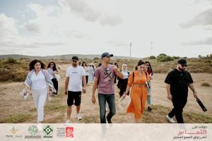
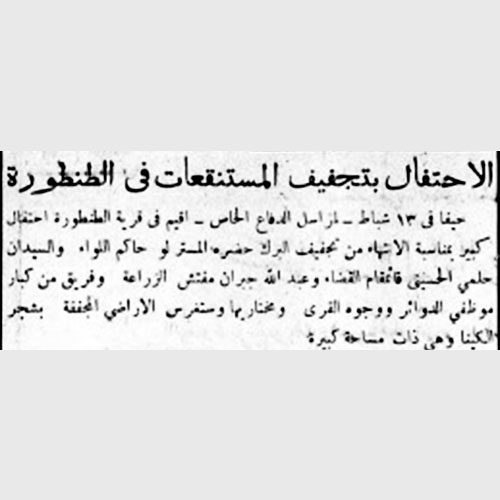
Today, the site has been transformed into a large recreational area, established in 1943 after the drainage of the harmful marshes and the planting of eucalyptus and other trees, in addition to a museum.
Source: Librarians